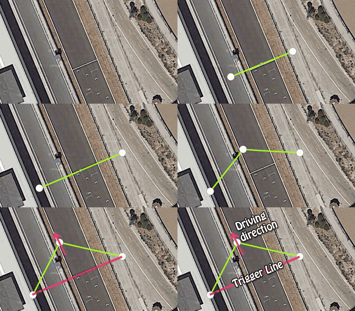
First off, I want to remind the use of the search box (in your profile, not here in the forum) to ensure that the track or stretch you want to create does not exist in the database , you can enter the track name, city, town or postal code to attempt to locate in the current databaseI will explain briefly, with graphic examples, how to make the start / finish and sectors linesand highlight certain details to make everything work
1 - Find the targetThe first thing to write is the city which the track or stretch belongs , we can also use coordinates, not much more to say, this step does not have much of mystery
 2 - Trigger Lines
Next we have to create trigger cut lines, these lines are used to determine the sart/finish line and the intermediate lines, if we are creating a
stretch or hillclimb we have to specify both lines
the start line and the finish line .
To create a line just determine where we want to start the line(click 1) and where we want to finish it(click 2), these points can be adjusted later, once created an additional point automatically appears in the middle of it, this point is used to
specify the driving direction and avoid false positives and common problems.

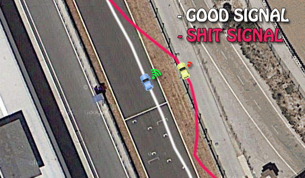
Some GPS have a considerable margin of error which "can get us out"
several meters away where we really are , that is why we must create
GENEROUSLY WIDE lines to maximize the possibility to trigger always the lap (even if we have a bad GPS) , on the other hand, when you are create the start/finish line on a racing racing,
do not forget to inclue the pit lane aswell  3 - Track Specs
 Once created the 3 trigger lines (4 lines if you are creating a strech) you only need to fill the track info (name, distance, whatever) and save the changes, the track will appear on your mobile under the tab "
own circuits " , anyone who visits your profile (if you are a public profile)
will see your tracks and and will be able to add they to his own database , so other users can race and compete at "your track"
BEST!